Author: Ada

To Single Portage or To Double Portage . . .

Quetico Provincial Park Kevlar Canoe Portage

For many canoe trip enthusiasts in the Boundary Waters and Quetico, portages are a necessary evil. Nothing slows down your paddling momentum faster than pulling into a canoe trip landing and having to completely unload your canoe. Even the shortest BWCA portage can be challenging and I fear for many campers, portages are something to be endured rather than enjoyed.

There’s really no “wrong” way to portage, although Andy and I would both encourage you to limit the amount of loose items in the bottom of the canoe to expedite the unloading process and lessen the risk of losing something. And obviously, you should practice canoe country courtesy at portages: keep your gear to the side of the portage landing, never completely block the portage path, and quickly vacate the portage landing so that other camping parties can land and start portaging themselves.

What Andy and I don’t agree on is how many times you should go over a portage. Andy and his buddy Andrew are firmly in the single portage camp. When we did the Granite River canoe route last spring, my friend Kati and I discovered that we greatly prefer to double portage.

DSC_0127

The driving factor for Andy and Andrew to single portage is that it allows them to cover a great distance quite quickly and gets them deeper into the wilderness faster. It allows them to cover as more miles in one day than many people cover over their entire canoe trip and it gets them into remote areas of the Quetico that many people never see.

If you have the luxury of owning the lightweight gear needed to make single portaging possible, you can be over and out of portages in 1/3 of the time that it will take those who double portage. When you can clear a portage in 20 minutes as opposed to 1 hour, you suddenly have a lot more time to play with on any given day. Andy and Andrew like to use that extra time to fish. Single portaging can also get you into camp quicker, which gives you more time to get the campsite set up just the way you want and can also mean you have more time to make more complex (aka more tasty) camp meals such as calzones, shore lunch, or camp baking experiments.

Until our trip last spring, I always thought single portaging was the ultimate goal of canoe tripping – something to be striven for at any cost. But the truth is, I feel rushed and uncomfortable when I single portage and that in turn makes me feel like I’m missing out.

Portaging the Granite River Boundary Waters Canoe Area

I don’t want to turn this into a gender divide, but physicality definitely plays into my preference to double portage. I’ve never been very successful at carrying a pack and a canoe simultaneously – it just doesn’t seem like my shoulder have enough real estate for both portage pads and Duluth pack straps. While Kati and I are both perfectly capable of carrying a 60 lb pack filled with all our camping gear, a heavy pack causes us to walk much slower and is more time consuming for us to load and unload at the portage landings. For us, carrying two 30 lb packs provides us with surer footing on the portage paths and eliminates that straining at the portage landings. While it might not actually be faster for us to double portage, we feel speedier because of the ease at which we can navigate each trip across the portage when we have a more comfortable amount of weight on our shoulders.

I like to think my preference for double portaging isn’t just a physical reaction, but reflective of my canoe trip philosophy. When you single portage, the goal is to get over the portage as quickly as possible so you can get on the water to get to the next portage to get over the portage as quickly as possible and so on, until it starts to feel like you’re wishing your canoe trip away. When you only see the portage path from beneath a burden, the things you notice are hazardous rocks, tree roots to avoid tripping over, and puddles of unknown depths.

But when you double portage, you get one lovely walk in the woods completely hands-free. This affords you time to notice tadpoles in those puddles, the wildflowers growing along the cedar tree roots, and dragonflies sunning themselves on the granite boulders. It’s a chance to simply be in the wilderness, to literally stop and smell the wild roses. For me, it’s one of the most enjoyable parts of a Boundary Waters trip.

What your preference? Are you team single portage or team double portage?
The Boundary Waters Is Not A Park and Other Unremarkable Revelations from 9 days in America’s Southwest

After an exceptionally beautiful start to April, the weather turned decidedly “April-ish” right around Easter. Serendipitously, we’d planned to travel for a week and a half at the end of April and we drove to the Duluth International Airport in 34 degree weather and a light rain.

Our very loose travel plan involved flying into Las Vegas, spending the night, picking up a rental car and getting the hee-haw out of Sin City.  We’d planned to head towards one of the many (many!) National Parks within a day’s drive of Vegas. In the end, we headed west and within three hours, we were buying an “America the Beautiful” pass at the Furnace Creek Visitor Center in Death Valley National Park. 

There’s always a bit of culture shock when we roll into a National Park. Like every kid from northeastern Minnesota, Andy and I have spent a lot of time on public land – mainly land managed by the Forest Service as National Forest. We’re pretty down with the idea that there are so many places in America that are too special to belong to just  a handful of people and should instead be made available to the masses. But we’re used to the U.S. Forest Service approach to land management of “hey, here’s some sweet woods you might want to check out at your own risk” vs. the National Park Service’s more hand-holding approach of pointing out every panoramic view worth taking a photo at and their focus on accessibility. On this trip, we saw so many amazing sights thanks to the National Park Service’s preservation work, but we also realized a lot of things that we’re thankful for in the Boundary Waters. 

In the Boundary Waters Canoe Area Wilderness, you travel at your own risk. This can sound scary, but what’s more off-putting: having to travel a little more carefully, or having a park ranger stationed every so often along your route watching you with binoculars in case of emergency? 

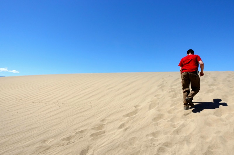
In the Death Valley Sand Dunes, we walked in 94 degree heat under the watchful eye of a paramedic park ranger who scanned the horizon of the dunes with binoculars, watching for potential heat exhaustion victims. 
Death Valley Sand Dunes

For better or worse, the BWCA doesn’t emphasize accessibility. Because the National Park system does, it can sometimes feel that an element of discovery is missing in national parks – like you’re seeing the park on someone else’s terms. When we climbed into the southeastern Sierrra Nevadas in Sequoia and Kings Canyon National Parks, the large parking lots at the General Sherman Tree and Grant Grove unwittingly made it seem like some trees were worth looking at and others, not so much, even though we were surrounded by spectacular views and towering sequoias and it was all worth taking in. 

Sequoia NP

Our time in the National Parks last month also made us really appreciate the quota system that regulates visitor usage in the Boundary Waters Canoe Area Wilderness. Say what you will about the Forest Service’s management plan for the BWCAW and the somewhat manufactured sense of wilderness it creates, but limiting the amount of people who can be in a certain area at a certain time often does translate into an elevated experience. In Zion National Park, we waited in a long line at the eastern entrance only find “no room at the inn” when we reached the visitor center parking lot. 

Zion Car Line

Zion’s been plagued with overcrowding for years now, and in an effort to combat the overcrowding, Zion implemented a mandatory shuttle bus for those wishing to visit the canyon in the peak season. However, this solution resulted in a parking nightmare at the base of the canyon, where people leave their vehicles for hours on end at the visitor center. As the day wears on, the parked cars start sprawling into the adjacent town of Springdale. Because UT Hwy 9 travels through Zion, everyone who takes Hwy 9 must pay park admission, even if they don’t plan to stop, a policy that likely inspires people to stop who initially might have been planning to just pass through. We enjoyed the beautiful sights along Hwy 9, but we never found a parking space and left feeling like Zion was a national park begging for some sort of daily admission cap.  

IMG_2212

But that’s not to say that every national park should pursue a daily admission cap. At the South Rim of the Grand Canyon, we were among thousands of visitors, but never had trouble parking and because of the park’s great infrastructure, were able to see every part of the South Rim that interested us, thanks to a combination of walking, shuttle bus, and car travel. 

Tourists Grand CanyonGrand Canyon NP

During our trip, we were reminded of the value of diverging off of any “travel top 10” list. While we visited a lot of very well-known national parks, our most enjoyable national park experience was in a national park I’d never heard of until a week before our trip when a random photo of a Facebook friend at Pinnacles National Park popped up on my feed. Both America’s newest and smallest national park, Pinnacles was a national monument for decades before President Obama designated it a national park in 2013. Although our visit landed smack-dab in Pinnacles’ peak season, we enjoyed a great hike through the park’s volcanic rock formations, spying condors soaring overhead and horny toad lizards hiding in the shade along the chaparral lined trail. Best of all, we felt like the park was ours to discover at our own pace. 

Pinnacles NP

Our trip wasn’t all national parks. We even managed to find a National Forest Wilderness area when we hiked into Woods Canyon south of Sedona, AZ. 

Sedona Wilderness

Perhaps some of the most rewarding time on the trip was spent on land managed by the State of California in the San Simeon area of the Pacific Coast and Hwy 1. A highlight was observing the elephant seal rookery of 6000+ seals. 

Elephant Seals San SimeonI’ve always loved touring big houses and William Randolph Hearst’s Hearst Castle atop the coastal hills of San Simeon did not disappoint. 
Hearst Castle

On the way from San Simeon to the Flagstaff, AZ area, we overnighted in Lake Havasu.

IMG_2181

We enjoyed Lake Havasu’s main attractions – 100+ degree heat and a great view of London Bridge. 
London Bridge Lake HavasuBy the time we reached Vegas for our return flight to MSP, we’d seen six national parks, visited 4 states, and traveled approximately 2000 miles. We made it back to Minnesota just in time to catch one final snowstorm of winter 2016-17 and prepare for the busy summer paddling season ahead. 
Current Lake Ice Conditions on the Gunflint Trail

Wondering what ice conditions are like on Gunflint Trail lakes? Well, wonder no more! We are quickly heading towards an earlier than average ice out on the Gunflint Trail, although, as usual ice conditions vary from lake to lake. Round Lake will likely be ice-free by tomorrow, while mid-Trail lakes still have a ways to go before they’re completely thawed.

We did an “ice tour” up the Gunflint Trail this morning, April 15. Verdict: time to dust off those paddles and make sure your canoe registration is up-to-date.

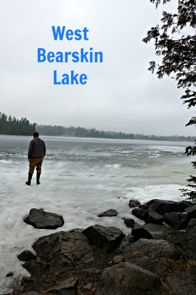
West Bearskin Lake April 15 2017
Little Iron Lake April 15 2017
Poplar Lake April 15 2017

Gunflint Lake April 15 2017

Cross Bay April 15 2017Round Lake April 15 2017Larch Creek April 15 2017Seagull Lake April 15 2017
Sag Lake Corridor April 15 2017

First Paddle of 2017!

Spring came early to the Gunflint Trail in 2017. The crocuses outside the outfitting building started blooming this week (that’s 2+ weeks ahead of when they bloomed last year) and the snow cover has disappeared from all but the darkest, coolest corners of the woods. With the seemingly endless string of sunny days that we’ve enjoyed over the last couple weeks, it’s hard to remember that we’re still in the first half of April and that the BWCA paddle season is still weeks away. 

Last weekend, the water level rose significantly in the section of the Cross River that runs beside the Round Lake Road. A dramatic rise in the rapids usually means that an iced-up section of the river upstream has let loose. 

On Tuesday, Andy and I decided to take advantage of the sunshine by going for a walk around the neighborhood. A couple steps out of the front door, we realized that we didn’t have to go for a walk . . . we could go paddle into Ham Lake. So we turned on a dime and headed over to the canoe yard to throw the Royalex Champlain (aka, the Bathtub) in the back of the pick-up and drove down to the Cross Bay entry point. 
Cross Bay Entry Point Dock April


At first glance, it looked like a large section of ice that had drifted into the landing dock would immediately hinder our adventure, but we were able to sneak around the edge of the iceberg to make it to the first portage. 


First Portage to Ham Lake April

The first portage landing on the route to Ham Lake is fairly shaded so there was plenty crystalized snow to pick through. Although the partial snow cover made them slightly treacherous, we sure appreciated the steps the U.S. Forest Service installed on this portage last August with a group of volunteers. 

Ham Lake Portage April

A Royalex canoe is a great early season canoe option because it is much warmer than an aluminum canoe (those aluminum bench seats can be chilly) and you don’t have to be as careful with it at portage landings as you would with a Kevlar canoe. Of course, it does weigh about 80 lbs, but that didn’t phase me . . . until Andy made me portage it on the trip back to the landing. <cue the sad trombones> 
Cross River Rapids April

Except for a few icebergs here and there, the route to Ham Lake was wide open and we scared up quite a bit of water fowl (including a dozen Canadian geese) as we traveled through one of the only navigable stretches of open water on the Gunflint Trail. But once we got to Ham Lake, the smooth sailing came to an abrupt end. 

Iced In Ham Lake April

You can reach the first campsite on Ham Lake. Not sure what you’d do there (catch up on your reading? Watch for ice out?) if you were to camp there right about now, but you could easily reach it in about a 25 minute paddle from the Cross Bay entry point. 
Ham Lake First Campsite AprilAndy Tuscarora BWCA Paddle April

Ham Lake Portage Trail BWCA AprilCross Bay Entry Point BWCAW April

It’s been a hard year to make accurate ice-out predictions for Gunflint Trail lakes. This year’s weird winter weather, particularly the rain that we received, seems to have changed the molecular structure of the lake ice and in turn, effecting how the ice melts. Instead of turning dark and candling as per usual, the ice this year seems to be turning into white slush and simply dissolving. 

Andy describes Gunflint Trail lake ice conditions in this video from Thursday, April 13: 

At any rate, even with the cooler weather predicted for next week, we think it’s fair to say that in a week’s time, we’ll probably be able to paddle Ham Lake and maybe even the entire Snipe Loop. It won’t be a record-breaking Gunflint Trail ice-out ala 2012 and 2010, but it will be a very early Boundary Waters paddling season at Tuscarora Lodge and Canoe Outfitters for sure. 

What’s the earliest BWCA canoe trip you’ve ever taken? 

A Trip Down Memory Lane

In its 82-year history on the Gunflint Trail, Tuscarora has evolved from boat-in cabins on Tuscarora Lake to the Boundary Waters canoe outfitters with lakeside cabins on Round Lake that it is today.

Much of what you see when you drive into Tuscarora – right down to that distinctive “Tuskie Tan” paint color – is compliments of the Leeds family, who owned and operated the Lodge from the late 1970s until the early 2000s. The dining hall, outfitting/office building, and a couple of the year-round cabins were constructed in the late 1980s and early 1990s and while it’s hard for us to imagine the property without these buildings, many long-time cabin guests distinctly remember what the property looked before. 

It’s always fascinating to talk with these guests to try to draw up a mental picture of what Tuscarora must have looked like “back when.” 

Members of the Hans Anderson family have been cabin guests at Tuscarora for decades and a month ago, Hans’ daughter, Mary, sent several photos her dad took during their annual Tuscarora vacations between 1977 – 1981 and finally we were able to visualize retro Tuscarora. 

DSC00371

This log cabin was located where Cabin 3 sits today. 
image009 image001 image002

The sandy beach down from Cabin 5&6. 

image003

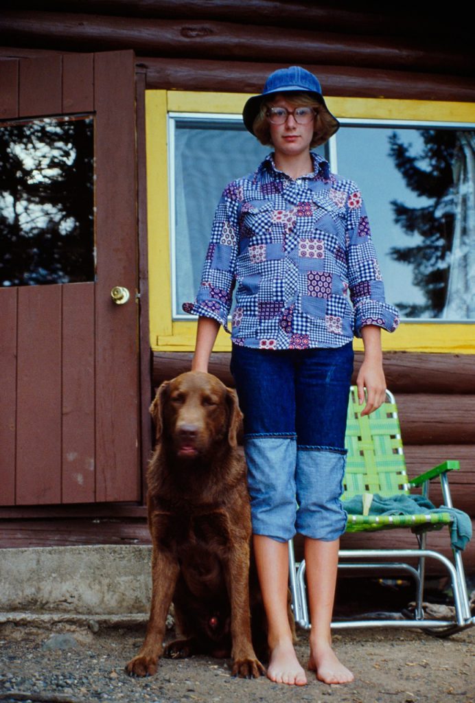
Laundry day in front of Cabin 6. 

image004

Before the dining hall was constructed in the late 1980s, guests ate their French toast breakfast in the Lodge, which is now a rental cabin. 

image005 image006 image007 image008

Do you remember when Tuscarora looked like this? If you have any old photos to share from your Tuscarora vacations, we’d love to see them!