Author: Ada

Ice Out Trip to Saganagons – Guest Post

Scott Schilling is a Gunflint Trail cabin owner and before that, he was a longtime Tuscarora guest who went on countless Boundary Waters and Quetico fishing trips. He answered our call for guest posts with this humorous memory of his first-ever Quetico fishing adventure and some great vintage canoe country photos.

Please note, all opinions expressed in this post are those of Scott and Scott alone. They do not necessarily reflect the opinions of Tuscarora, Tuscarora staff, or Tuscarora guests . . . about engineers. And remember, always wear your lifejacket!

Scott writes:

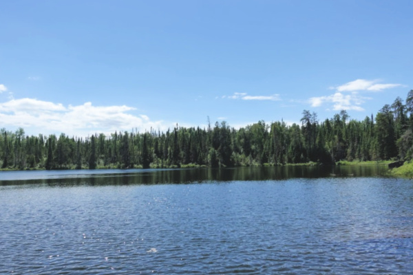
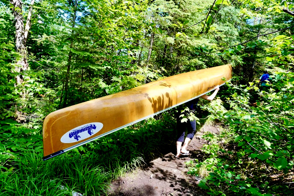
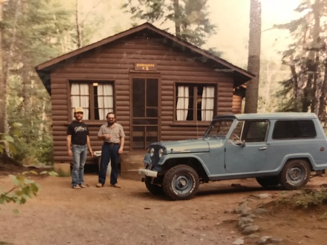
Every May, for 15 years, we’d drive 700 miles from Illinois to spend a week in Quetico. We’d stay in a Tuscarora bunkhouse for our first night. After getting minimal sleep because of the anticipation, we’d get a tow on Saganaga to save us several hours of canoeing and to ensure we could get to our designated campsite by dark, as it was several hours of canoeing, and back then, going through customs on the water, portaging etc.  Our tow boat would then drop us off in the water, and say “See you in a week . . . . Hopefully.”

Scott’s group outside Bunkhouse 2 at Tuscarora Lodge and Canoe Outfitters

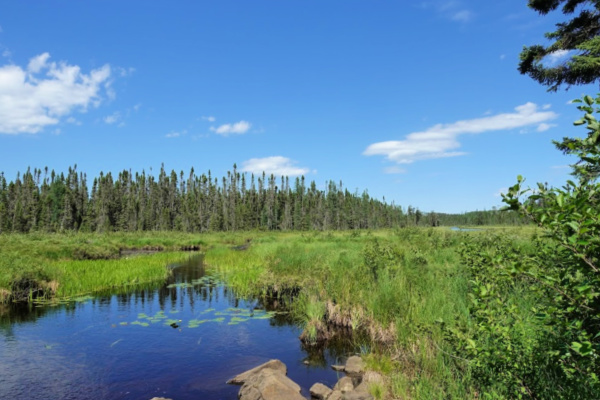
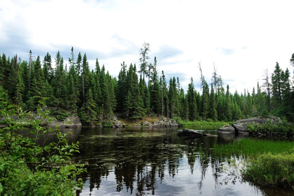
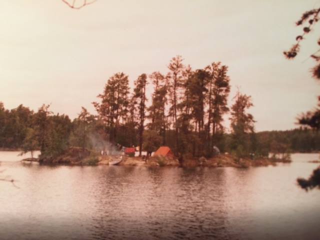
We’ve seen Cache Bay with 3-4’ waves and calm as glass. We sometimes camped just prior to Silver Falls for the first night, but most years we made it to the same island up in Saganagons to get camp established the first night. Our first trip ever was just after ice out.

Imagine the excitement . . . . We’d spent a year planning, working out on a steep hill with a backpack full of weight to get our bodies ready, and figuring out what and what not to pack. I’d listened to my engineer friend for a year, with all his extreme cautions, lists etc. I’m the opposite . . . like whatever, I only need a few things.

Now, on our first morning of our first canoe trip ever, it was very cold and raining, but the weather was irrelevant. I knew on my first cast, I’d probably catch a world record fish.

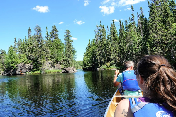
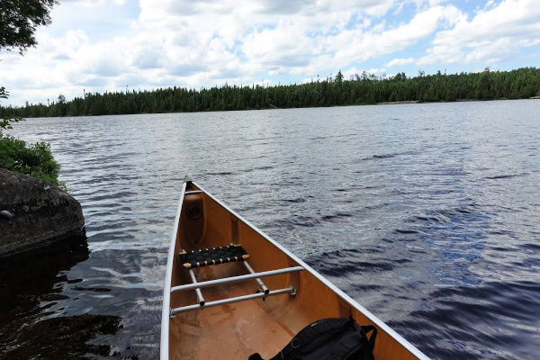
With me in the front seat, we pulled off our island campsite, got stabilized for a minute, and I grabbed my brand-new Garcia Ambassador 5500C reel that I was so proud of. As we just rounded the corner of an island, I saw my opportunity for my first cast ever. I swung my rod back to let my Smithwick Rogue – my favorite lure which has worked all over the country – fly out parallel down the bank.

My hands were already wet from the rain. As I palmed that bait caster to make that long cast, my first cast ever up there, the reel slipped out of my hand. It shot 3-4’ up into the air and I watched it come down, probably 3’ from the canoe.

I instinctively went to reach out and grab it, as I wasn’t losing my new rod reel for the week. It was just far enough from the canoe and as I reached for it, I capsized the canoe. My engineer friend was already screaming and cussing at me, when my head popped out of the water. “Now what, you idiot?” he yelled. “We just lost everything for the week!”

I’d never been canoeing before this, never capsized a canoe, never been in ice out freezing water with several layers of clothes and boots on, never been on a trip with this anal engineer, never been stranded on an island. Once he stopped yelling, he said, “Don’t leave the canoe, it won’t sink.”

We managed to drag the canoe full of water and seemingly weighing about 300 pounds to the island. As we slid up the rocks in all our wet clothes, I was like, oh crap, what now? My buddy just kept saying, “That’s it. No fishing now for a week.”

All our rods and reels were at the bottom of the lake.

We managed to empty the water out of our canoe. We saw our paddles and life vests (of course they weren’t on) floating in the lake. We got back into the canoe and hand paddled out to get them.

Then I noticed something.

The Rogue I was using was a topwater lure, and I saw it floating on the water. Could I possibly pull my rod up? My buddy was still lipping off the whole time. As I grabbed the Rogue, I started to pull my line in very carefully as I had released the spool to cast. Would my knot hold at the bottom of the spool? It felt quite heavy for some reason, and after pulling about 50 yards of line, I started to see several rods coming up!

All of the rods, we had in the canoe had miraculously entangled somehow, and in one motion I grabbed them all. Now I proudly told my anal engineer buddy to shut up. All we lost was one compass . . . .Who needs that anyway?!

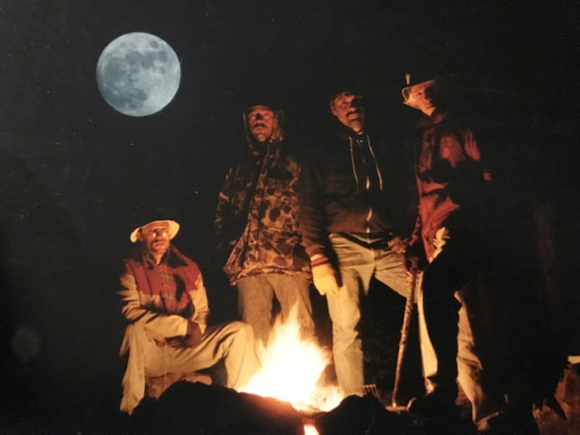
Froze, numb, dumbfounded, and disarrayed, we went back to our camp, managed to get a blazing fire started. We thawed out, warmed up, recalibrated, laughed, and started over.

We went on to have a phenomenal week of fishing. Believe it or not, we were able to save two other canoers that week. They were the only other people we saw during the trip and they had capsized in the middle of Saganagons and were in rough shape when we found them.

That was the first week of what’s now been 43 years up there. Couldn’t get that sitting on a couch in Illinois.

Do you have a story you’d like to share with Tuscarora guests? Email us the text and some photos to us at info@tuscaroracanoe.com. We’d love to share it!

A Guide to Winter Parking on the Gunflint Trail

North Gunflint Lake Snow Plow Turnaround
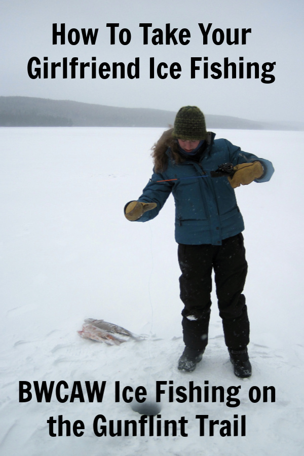
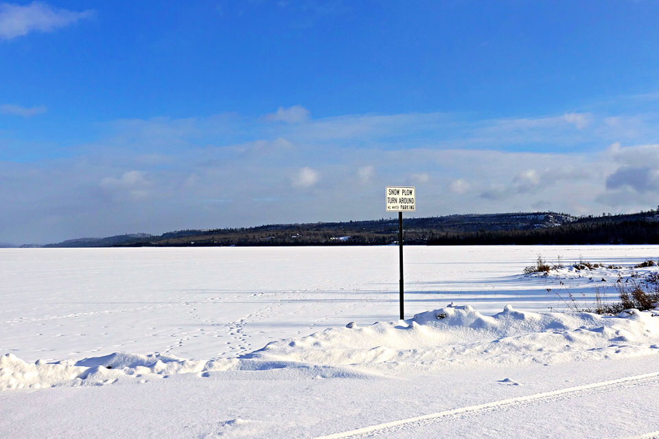
Before heading up the Gunflint Trail for winter camping or ice fishing, make sure you know where to park. Winter parking on the Gunflint Trail often surprises first-time winter visitors because many of the public landings used for summer Boundary Waters trip starts aren’t plowed out. In fact, parking on the Gunflint Trail in the winter can feel like a kind of wink-y, “gotta be in the know” sort of situation.

Since getting all confused by parking right out of the gate isn’t the most auspicious start to the perfect winter camping trip or day trip, we’ve put together a handy guide to winter parking on the Gunflint Trail for every Gunflint Trail Boundary Waters entry point. If you’re a visual person, check out our video tour of Gunflint Trail winter parking areas. 

Winter parking can be confusing on the Gunflint Trail. Give us a call at 218-388-2221 with any questions you have about it. We can help point you in the right direction, regardless of which Gunflint Trail BWCA entry point you’re using. 

Gunflint Trail Parking Guide for Winter Campers and Winter Boundary Waters Visitors

BWCA Entry Point Public Landing Winter Status Winter Parking notes
#43 Bower Trout Not plowed Two options for winter parking: The South Brule snowmobile trail parking lot off the Gunflint Trail just south of the Greenwood Lake Road. There is also frequently a small parking area plowed out on Forest Service Road 152 (Lima Mountain Road) with room for a couple cars. Due to the distance between parking areas and entry points, access without a snowmobile is very difficult. 
#44 Ram Not plowed Two options for winter parking: The South Brule snowmobile trail parking lot off the Gunflint Trail just south of the Greenwood Lake Road. There is also frequently a small parking area plowed out on Forest Service Road 152 (Lima Mountain Road) with room for a couple cars. Due to the distance between parking areas and entry points, access without a snowmobile is very difficult. 
#45 Morgan Not plowed Two options for winter parking: The South Brule snowmobile trail parking lot off the Gunflint Trail just south of the Greenwood Lake Road. There is also frequently a small parking area plowed out on Forest Service Road 152 (Lima Mountain Road) with room for a couple cars. Due to the distance between parking areas and entry points, access without a snowmobile is very difficult. 
#64 East Bearskin Not plowed Contact Bearskin Lodge at 218-388-2292 in advance to make parking arrangements
#62 Clearwater Plowed Sometimes there’s parking lot plowed on the lake off the public landing. If not, make sure to park as far south as possible in the lot to allow enough room for the county snow plow to turn around. Contact Clearwater Lodge at 218-388-2254 with any questions. 
#60 Duncan Plowed For easiest/fastest access, use public parking lot at the very end of County Road 21 (Hungry Jack Lake Road)
#61 Daniels Plowed For easiest/fastest access, use public parking lot at the very end of County Road 21 (Hungry Jack Lake Road)
#47 Lizz and Swamp Not really plowed Best option call a Poplar Lake business (Trail Center, Nor’wester, Poplar Haus, Big Bear Lodge, or Rockwood) to make parking arrangements. There is a very small parking area plowed out at the start of the Poplar Public Lake Access Road off of County Road 92 with room for 1-2 vehicles max. Be careful not to block the nearby driveway. 
#48 Meeds Not really plowed Best option call a Poplar Lake business (Trail Center, Nor’wester, Poplar Haus, Big Bear Lodge, or Rockwood) to make parking arrangements. There is a very small parking area plowed out at the start of the Poplar Public Lake Access Road off of County Road 92 with room for 1-2 vehicles max. Be careful not to block the nearby driveway. 
#49 Skipper and Portage Not really plowed Best option call a Poplar Lake business (Trail Center, Nor’wester, Poplar Haus, Big Bear Lodge, or Rockwood) to make parking arrangements. There is a very small parking area plowed out at the start of the Poplar Public Lake Access Road off of County Road 92 with room for 1-2 vehicles max. Be careful not to block the nearby driveway. Portage Lake can also be accessed by parking at the Little Iron Lake parking lot off the Gunflint Trail. 
#58 South Technically plowed Most winter visitors to South access the lake via the Mayhew Lake Rd. Small parking lot plowed off the Gunflint Trail – be sure not to park anyone in. 
#57 Magnetic Technically plowed Not a recommended winter destination due to bad ice from moving current
#50 Cross Bay Not plowed Not a recommended winter destination due to bad ice from moving current
#51 Missing Link Not plowed A parking area is plowed out at the start of the Round Lake Public Access Road off of County Road 47 (Round Lake Road) with space for 4-5 vehicles. Parking also often available at Tuscarora Lodge and Canoe Outfitters (218-388-2221) if you make arrangements in advance. 
#52 Brant Not plowed A parking area is plowed out at the start of the Round Lake Public Access Road off of County Road 47 (Round Lake Road) with space for 4-5 vehicles. Parking also often available at Tuscarora Lodge and Canoe Outfitters (218-388-2221) if you make arrangements in advance. 
#80 Larch Creek Not plowed Not a recommended winter destination due to bad ice from moving current
#54 Seagull Plowed Best option: park at the Blankenburg Public Landing lot at the end of the Seagull Lake Access Road to access the southeast corner of Seagull Lake. Alternative parking is available at the entrance to End of the Trail campground, but not recommended due to bad ice on the Seagull River.
#55 Saganaga Plowed Both county parking lots for Saganaga Lake (on County Road 81/Moose Pond Drive and County Road 83/Sag Lake Trail) are plowed and free of charge in the winter months. 


Curious about parking at a specific Boundary Waters entry point off the Gunflint Trail this winter? Click on its link below for a video tour.

Seagull Campground Landing
Seagull Landing (Blankenburg)
Saganaga Lake (Moose Pond)
Saganaga Lake (Sag Lake Trail)
Missing Link and Brant (Round Lake)
Duncan and Daniels (West Bearskin)
Clearwater Lake
South Lake (Via Topper)
Lizz, Swamp, Meeds, and Skipper (Poplar Lake)
East Bearskin
Ram, Morgan, Bower Trout

Snipe Lake Loop Day Trip

Last June, I was able to sneak out for an afternoon day trip on the Snipe Lake Loop with my brother and sister-in-law when they were up. This short Boundary Waters Canoe Area Wilderness canoe route basically loops through Tuscarora’s backyard. We frequently send cabin guests and a handful of overnight campers on this route because it’s convenient, scenic, and provides an excellent introduction to the BWCA.  

It was a glorious sunny day, so we grabbed a three-person Kevlar canoe and off we went . . . . 

Missing Link Lake

As the name “loop” implies, this route can be done in two directions, either starting on our beach on Round Lake, or just down the Round Lake Road (County Road 47) at the public put-in for Cross Bay Lake. The three of us opted to start at Tuscarora for a couple reasons. Logistically, it was just easier to start at the beach since our canoes are right there and we didn’t have to monkey around with shuttling ourselves and canoe down the road . . . even if it is only 300 yards away from the outfitting building. I also liked the idea of getting the two longer portages done first thing (the portage from Round to Missing Link is 142 rods and the portage from Missing Link to Snipe is 180 rods), although by doing the route in the counterclockwise direction, we of course had more uphill portaging . . . . Clearly, a compelling argument can be made for doing the loop in either direction. 

Brother at the Snipe Portage landing on Missing Link

It was a mid-week afternoon in late June and the woods were still pretty quiet. We ran into a group coming across the Missing Link portage, then passed a large group on the first campsite on Missing Link. From then on, we had the woods to ourselves. 

One of the nice things about doing the Snipe Lake Loop with three people in a three-person canoe is that it’s easy to navigate the single biggest challenge on the entire six-mile route. About a quarter of a mile down the portage between Missing Link and Snipe Lake, you come to a large boulder that slopes down into a ravine. It’s only about a seven foot dip, but it can be a bit of a poser on how to tackle it when you come to this “valley” with a canoe on your shoulders. If you’re traveling by yourself or just one other person, the only real option is to set the canoe down, get yourself down the rock face, then collect the canoe and carry on. 

My brother Peter was portaging the canoe when we reached this point, so his wife Ashley and I just grabbed the two ends of the canoe and held it up while Peter walk out from under the canoe and down the rock face. Once he was on level footing again, we just set it back down on his shoulders and continued on to beautiful Snipe Lake.

Snipe Lake

Snipe Lake really is a gem. Even though you’re only a couple miles into the BWCA, it feels like you’re deep in the wilderness. It has dramatic rock features, twisty canyons, and lush forest. It’s not a great lake for fishing (it just has small northerns) but with four campsites and not a lot of traffic, it’s a good option for people who want to feel like they’re in the remote wilderness without actually traveling very far. 

That said, there’s some debate about whether the Snipe Lake Loop is “easy.” Because of its convenient location, many Tuscarora guests get their first taste of the Boundary Waters on the Snipe Loop. It’s not the easiest Boundary Waters canoe route in the world, but it has several factors that push it into the “easier” category, namely that you only travel six miles to complete the whole loop meaning it can be done in about three and a half hours of continuous paddling and portaging. It’s also only on small bodies of water so you don’t have to worry too much about wind conditions. While two of the portages are longer, all of the portages are well traveled and well maintained.

But every Boundary Waters trip inherently challenging on some level and even the easiest BWCA trip isn’t a walk in the park. (I actually wrote a whole blog post about the Boundary Waters not being a park a couple years ago.) As you can see in the photo above, the portages can be mucky. On Cross Bay Lake, the person in the bow needs to watch in front of them so the canoe doesn’t get hung up on the bottom or rocks as you paddle the shallow areas near the portages. 

When you take off on Cross Bay Lake from the Snipe portage, you meander down a shallow, twisty waterway about creek-width. Be sure to watch for blooming pitcher plants if you’re paddling through in early summer. We literally saw hundreds of these carnivorous flowers in bloom as we paddled by – the most I’ve ever seen in one location.  Although we didn’t see one on this trip, Cross Bay Lake is also know to be a bit of a moose viewing hot spot. 

Cross Bay Lake

As you portage from Cross Bay Lake into Ham Lake, you’ll exit the Boundary Waters. You still have two portages to go to reach the public landing though. Ham Lake is completely outside of the Boundary Waters Canoe Area Wilderness, but still in the Superior National Forest. That means the four campsites on this lake are “dispersed sites” aka first come, first serve campsites that don’t require an overnight permit (or camping fee) to camp here. As a result, this lake can be pretty busy in the Boundary Waters high season (late July – mid August) when Boundary Waters permit quotas are filled, but people are still looking to get a BWCA camping experience. It’s also a lake that people frequently camp on for the last night of their overnight trip down to Long Island Lake or beyond, because Ham Lake has a good population of walleye and bass. Despite these facts, all four campsites were empty when we paddled past. 

From Ham Lake, we continued on for the “portage/paddle/portage/paddle” around a couple sets of rapids on the Cross River back to the public landing. From there, we did a quick 1/3 mile walk up the road back to Tuscarora. Although we did the trip as a day trip, I could see why you’d choose this route for an overnight trip. For such a short BWCA route, it really has some great campsite options, especially if the purpose of your trip is to relax and recharge and fishing isn’t much of a priority.

Have you done the Snipe Lake Loop before? 

New Boundary Water Maps from True North Map Company

Like many, if not most, people who love the Boundary Waters Canoe Area Wilderness, we’re map people. To us, half the joy of BWCA canoe tripping is pouring over maps and weighing the merits of one route over another in the months leading up to the actual trip. Even if you’ve only gone on one Boundary Waters trip, chances are, you still have at least one map from that trip. The Boundary Waters and maps – they just go together. 

For a long time, you had to make a binary choice about which map you wanted to use for Boundary Waters navigation: a Fisher or a McKenzie. We use these two companies’ maps interchangeably at Tuscarora, since the only real differences between the two are the scale and the background color. Back in 2007,  Voyageur Maps joined the Boundary Waters map party, so it had been a good long while since there’d be anything new in the Boundary Waters map world. Suffice it to say, we were pretty excited when Hudson, Wisconsin based True North Map Company launched in January. 

The tan background indicates areas affected by wildfire, while the green background shows old growth forest

We got our first shipment of True North Maps a few weeks back. We were intrigued by the concept of the maps, but wanted to test out their functionality. Since then, the maps have accompanied us on many a Boundary Waters ice fishing trip (see #7daysoficefishing over on Instagram) and we’ve even thrown one in the wash. (More on that later . . . . )  

If you’re asking yourself, do we really need another company making Boundary Waters map, the answer is no, we don’t really need another company printing BWCA maps on paper. Happily, True North Map Company isn’t printing their maps on paper. What sets them apart from every other Boundary Waters map company is that their maps are printed on microfiber fabric –  think the kind of material that your Buff is made out of. This means you can literally tie these maps in knot, in a bow, throw them over your shoulder, or wear them as a bandana. 

We kind of wondered how clear a map printed on fabric could be, but were pleasantly surprised by how clearly the lakes “pop.” The True North maps cover all the things you’d expect from a Boundary Waters map: lake and island names, campsite locations, portages with the distance in rods, campsites, and of course the actual Boundary Waters boundary. With a scale of 1 mile = 1.5,” the scale is the same as on Fisher maps, although the True North maps don’t have as much lake depth detail. They do however offer detailed topography and use color grading to show forest fire areas.

From a navigation standpoint, where True North maps really shine are as a secondary map for the “non-navigator” in the canoe. It’s always nice to have as many people as possible on the trip aware of your position on the map to increase your chances of remaining “found.” 

I also think this is an excellent map option for a route you’re already familiar enough with that you don’t require notation on the map. With a True North map, you can just ball it up in your pocket and pull it out whenever you want to verify you’re on the right course. Maybe it’s just me, but when I go on a Boundary Waters day trip, I always find it a little annoying to have to carry a single map over the portages, since the map case is usually too big to easily stuff into my daypack. But as Dave Seaton down at Hungry Jack Outfitters is fond of saying, “If you don’t have a map, you’re lost; you just don’t know it yet,” so traveling without a map really isn’t an option, no matter how well you know a route.  With a True North Map, I can just tie the map around my leg or to the canoe and enjoy hands-free portaging. 

Made of UPF 50 microfiber fabric, True North maps can be used for sun protection . . . or any of your Boundary Waters banditry needs.

Personally, the thing we’ve enjoyed most about these maps isn’t their navigational function, it’s been having a microfiber cloth close at hand. We’ve grabbed them many a time to dry our hands after catching a lake trout or to wipe water off the fish finder screen. The maps are machine washable, and I can verify that they come out of the washing machine just as bright as they went in (and in my case, decidedly less fishy smelling). Be sure to line dry them so they stay nice and soft.  

As a canoe outfitter, one of things we’ve really enjoyed about working with True North Maps is how customizable the maps are. We’ve worked together to move a portage location to improve the maps’ accuracy. They even cut a custom map for us (the BWCA TL) that specifically shows the areas you’ll travel through with #50 Cross Bay, #51 Missing Link Lake, or #52 Brant Lake entry point permits. The custom map also shows Tuscarora Lodge and Canoe Outfitters’ location. We’ll be stocking those in our gift shop this season, along with their BWCA 13 map, which covers Seagull and Saganaga Lakes and the entire Granite River.  

The BWCA TL map goes as far west as Little Saganaga and Gabimichigami, shows the entire Frost River Loop, and goes as far south as Sawbill.

How To Take Your Girlfriend Ice Fishing

First things first, let’s just clear the air by stating that the following blog post is not exclusively about taking your girlfriend ice fishing. It’s about taking your girlfriend, boyfriend, best friend, or any other slightly reluctant adult ice fishing for the first time. We were simply inspired by the recent video on Jay Siemens’ Youtube channel about “What NOT to do when you take your girlfriend ice fishing.” This is not a gender specific post. Whew! Moving on . . . . 

As a girlfriend who has been taken ice fishing, I have a little insight on this subject. I went ice fishing a grand total of once as a child (it was cold, we caught one fish) and it wasn’t until I was in my mid-twenties that ice fishing became a regular winter activity for me. Since I wasn’t raised by anglers, I’m not sure I could have really explained what a tip-up was on that first “grown-up” ice fishing trip, so the ball was firmly in the court of the person taking me ice fishing to show me it was an experience worth repeating. Luckily, Andy was up to the challenge, and while I might not always be the most cheerful ice fishing companion (see photo below), for the last decade, I’ve accompanied Andy ice fishing on a fairly regular basis.  

 
If you’re looking to turn your BFF into an IFFF – that’s short for “Ice Fishing Friend Forever – here are our best tips to get them enjoying ice fishing so that they’re actually willing to go ice fishing with you again (and again and again): 

Action, action, action 

The tips we go over in last year’s “The Best Ice Fishing Lakes for Kids” post are as applicable to adult first-timers as they are to kids. For that first ice fishing trip with your would-be IFFF, you want to choose a lake that you’re confident can deliver fast results. We know you’re excited to take your significant other out fishing, but now’s not the time to take them out to that one lake you need to bushwhack into that you’ve heard good things about but you’ve never actually fished. Take them to a lake you know well and to a spot that consistently delivers. 

Don’t abuse their good nature

Here’s a scenario for you. Let’s say your significant other is really into running. You’ve watched them lace up their shoes religiously every other day, you’ve cheered them on at countless 5ks, and now they’re training for their first marathon. You’ve never run a mile, but you’re inspired. You mention in passing that you’d like to go running with them some time. They take you up on your offer and invite you along on their next run. Now are you more likely to going running with them a second time if they A) take you out on a five-mile tempo run with no water breaks or if they B) take you on a leisurely run/walk option around a couple blocks?   

If your partner announces that they’d like to go ice fishing with you sometime, YAY! Now wield your power carefully. While you might suddenly have visions of that snowmobile-in ice fishing trip in Manitoba you’ve been dreaming of finally becoming a reality, now is not the time to start planning a multi-day ice fishing expedition. Nope, now is the time to carve out a couple hours on a sunny afternoon for a low-key, low-pressure first-time ice fishing trip. You want your partner saying, “hey that was pretty fun, when can we go again?” not “Can we go home now?” 

There is such a thing as too much helpful advice 

One of the best things you can do is rig up your partner’s rod with whatever tackle and bait you think works best for where you’re fishing and then letting them have at it. Maybe their jigging technique makes you cringe. Maybe you’re 100% sure they’re not dropping their line deep enough. Be conservative in how much advice you volunteer and don’t feel the need to coach them through every step. Sure, they might lose a couple fish on their way up to the hole before they totally get how to set the hook and keep tension on the line, but if they care, they will learn. If they don’t care, they’re not listening to you anyway, so save your breath. Let them ask the questions that will help them become better anglers and be okay with the fact that their techniques might differ from yours. Your way or the highway is not a good approach to ice fishing . . . or your relationship. 

Fun vs. fish

Remember, they’re not going to come with you again if they don’t have any fun, so you might have to let go of a little fishing hubris. Don’t get caught up in fishing ultimatums that you might hold yourself to if you were fishing alone. This is not the time to declare “we never pack up until a full half hour after sunset” or “nobody goes anywhere until one of us catches a 10 lb trout.” Maybe you never keep fish, but your fishing partner is pretty keen to take the fish they just landed home for dinner. Let them! It’s supposed to be fun.  

Consider latrine proximity 

While this is a gender specific tip, there’s no getting around the fact that toileting in the woods is more of an ordeal for women, especially when bundled up for winter weather. If you happen to be a male taking a female ice fishing off the Gunflint Trail for the first time, it’s a nice gesture to select a fishing area that’s close to a Boundary Waters campsite so they can use the latrine if they prefer.

Choose your date carefully 

You might be anxious to get out ice fishing as soon as the ice is safe, but if you’re looking to cultivate an IFFF, you might consider waiting to take that first ice fishing trip together until mid to late March. Along the Gunflint Trail, late March is the best time to go ice fishing because the longer, sunnier days knock down the snow and slush to make for easy lake travel and after the long winter, ice fishing in sunny 40 degree weather feels downright tropical and fantastic. Besides, nothing builds anticipation like having one great ice fishing trip in late March and then not being able to go again for another nine months.

Bring snacks and extra warm clothing 

If this is the first time your partner has gone ice fishing, they might not know what kind of outdoor clothing they need to be comfortable ice fishing, or they just straight up might not own the right clothing. To avoid your partner getting literal cold feet, throw in some hand and feet warmers, an extra jacket or vest, a balaclava, and an extra pair of mittens. A hot thermos of coffee or hot cocoa to share is a good way to warm up and pass the slow time when the fish aren’t biting. Don’t forget some snacks!