Tagged: Boundary Waters

Ice Out Trip to Saganagons – Guest Post

Scott Schilling is a Gunflint Trail cabin owner and before that, he was a longtime Tuscarora guest who went on countless Boundary Waters and Quetico fishing trips. He answered our call for guest posts with this humorous memory of his first-ever Quetico fishing adventure and some great vintage canoe country photos.

Please note, all opinions expressed in this post are those of Scott and Scott alone. They do not necessarily reflect the opinions of Tuscarora, Tuscarora staff, or Tuscarora guests . . . about engineers. And remember, always wear your lifejacket!

Scott writes:

Every May, for 15 years, we’d drive 700 miles from Illinois to spend a week in Quetico. We’d stay in a Tuscarora bunkhouse for our first night. After getting minimal sleep because of the anticipation, we’d get a tow on Saganaga to save us several hours of canoeing and to ensure we could get to our designated campsite by dark, as it was several hours of canoeing, and back then, going through customs on the water, portaging etc.  Our tow boat would then drop us off in the water, and say “See you in a week . . . . Hopefully.”
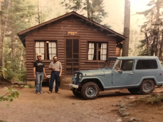
Scott’s group outside Bunkhouse 2 at Tuscarora Lodge and Canoe Outfitters

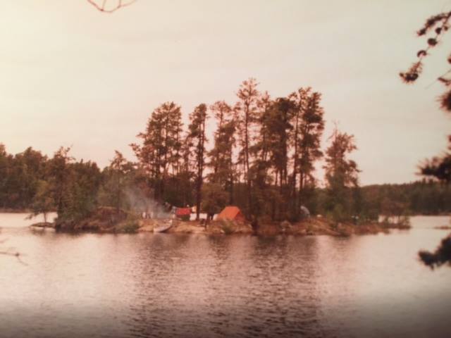
We’ve seen Cache Bay with 3-4’ waves and calm as glass. We sometimes camped just prior to Silver Falls for the first night, but most years we made it to the same island up in Saganagons to get camp established the first night. Our first trip ever was just after ice out.

Imagine the excitement . . . . We’d spent a year planning, working out on a steep hill with a backpack full of weight to get our bodies ready, and figuring out what and what not to pack. I’d listened to my engineer friend for a year, with all his extreme cautions, lists etc. I’m the opposite . . . like whatever, I only need a few things.

Now, on our first morning of our first canoe trip ever, it was very cold and raining, but the weather was irrelevant. I knew on my first cast, I’d probably catch a world record fish.

With me in the front seat, we pulled off our island campsite, got stabilized for a minute, and I grabbed my brand-new Garcia Ambassador 5500C reel that I was so proud of. As we just rounded the corner of an island, I saw my opportunity for my first cast ever. I swung my rod back to let my Smithwick Rogue – my favorite lure which has worked all over the country – fly out parallel down the bank.

My hands were already wet from the rain. As I palmed that bait caster to make that long cast, my first cast ever up there, the reel slipped out of my hand. It shot 3-4’ up into the air and I watched it come down, probably 3’ from the canoe.
I instinctively went to reach out and grab it, as I wasn’t losing my new rod reel for the week. It was just far enough from the canoe and as I reached for it, I capsized the canoe. My engineer friend was already screaming and cussing at me, when my head popped out of the water. “Now what, you idiot?” he yelled. “We just lost everything for the week!”

I’d never been canoeing before this, never capsized a canoe, never been in ice out freezing water with several layers of clothes and boots on, never been on a trip with this anal engineer, never been stranded on an island. Once he stopped yelling, he said, “Don’t leave the canoe, it won’t sink.”

We managed to drag the canoe full of water and seemingly weighing about 300 pounds to the island. As we slid up the rocks in all our wet clothes, I was like, oh crap, what now? My buddy just kept saying, “That’s it. No fishing now for a week.”

All our rods and reels were at the bottom of the lake.

We managed to empty the water out of our canoe. We saw our paddles and life vests (of course they weren’t on) floating in the lake. We got back into the canoe and hand paddled out to get them.

Then I noticed something.

The Rogue I was using was a topwater lure, and I saw it floating on the water. Could I possibly pull my rod up? My buddy was still lipping off the whole time. As I grabbed the Rogue, I started to pull my line in very carefully as I had released the spool to cast. Would my knot hold at the bottom of the spool? It felt quite heavy for some reason, and after pulling about 50 yards of line, I started to see several rods coming up!

All of the rods, we had in the canoe had miraculously entangled somehow, and in one motion I grabbed them all. Now I proudly told my anal engineer buddy to shut up. All we lost was one compass . . . .Who needs that anyway?!

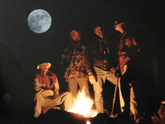
Froze, numb, dumbfounded, and disarrayed, we went back to our camp, managed to get a blazing fire started. We thawed out, warmed up, recalibrated, laughed, and started over.
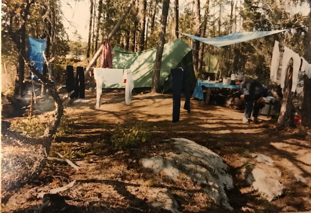
We went on to have a phenomenal week of fishing. Believe it or not, we were able to save two other canoers that week. They were the only other people we saw during the trip and they had capsized in the middle of Saganagons and were in rough shape when we found them.

That was the first week of what’s now been 43 years up there. Couldn’t get that sitting on a couch in Illinois.
Do you have a story you’d like to share with Tuscarora guests? Email us the text and some photos to us at info@tuscaroracanoe.com. We’d love to share it!
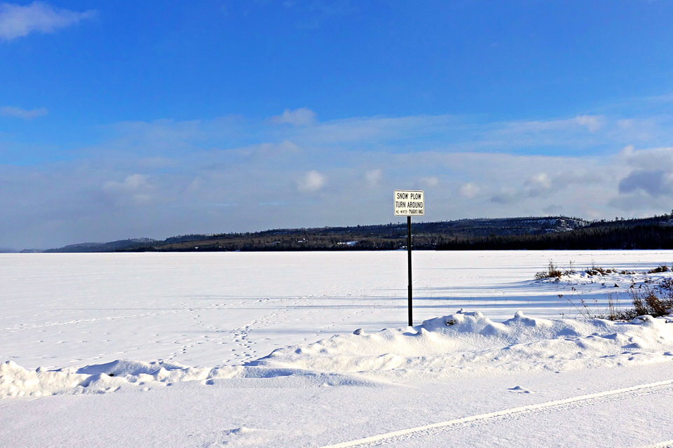
A Guide to Winter Parking on the Gunflint Trail

North Gunflint Lake Snow Plow TurnaroundBefore heading up the Gunflint Trail for winter camping or ice fishing, make sure you know where to park. Winter parking on the Gunflint Trail often surprises first-time winter visitors because many of the public landings used for summer Boundary Waters trip starts aren’t plowed out. In fact, parking on the Gunflint Trail in the winter can feel like a kind of wink-y, “gotta be in the know” sort of situation.
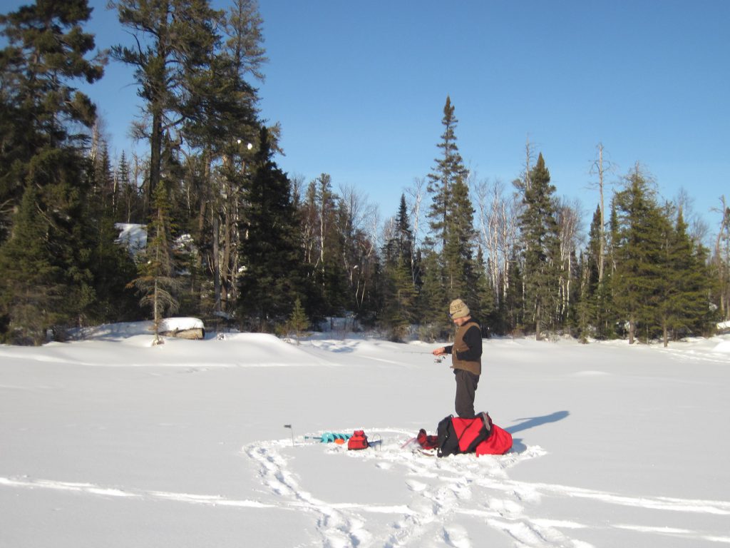
Since getting all confused by parking right out of the gate isn’t the most auspicious start to the perfect winter camping trip or day trip, we’ve put together a handy guide to winter parking on the Gunflint Trail for every Gunflint Trail Boundary Waters entry point. If you’re a visual person, check out our video tour of Gunflint Trail winter parking areas. 

Winter parking can be confusing on the Gunflint Trail. Give us a call at 218-388-2221 with any questions you have about it. We can help point you in the right direction, regardless of which Gunflint Trail BWCA entry point you’re using. 

Gunflint Trail Parking Guide for Winter Campers and Winter Boundary Waters Visitors

BWCA Entry Point Public Landing Winter Status Winter Parking notes
#43 Bower Trout Not plowed Two options for winter parking: The South Brule snowmobile trail parking lot off the Gunflint Trail just south of the Greenwood Lake Road. There is also frequently a small parking area plowed out on Forest Service Road 152 (Lima Mountain Road) with room for a couple cars. Due to the distance between parking areas and entry points, access without a snowmobile is very difficult. 
#44 Ram Not plowed Two options for winter parking: The South Brule snowmobile trail parking lot off the Gunflint Trail just south of the Greenwood Lake Road. There is also frequently a small parking area plowed out on Forest Service Road 152 (Lima Mountain Road) with room for a couple cars. Due to the distance between parking areas and entry points, access without a snowmobile is very difficult. 
#45 Morgan Not plowed Two options for winter parking: The South Brule snowmobile trail parking lot off the Gunflint Trail just south of the Greenwood Lake Road. There is also frequently a small parking area plowed out on Forest Service Road 152 (Lima Mountain Road) with room for a couple cars. Due to the distance between parking areas and entry points, access without a snowmobile is very difficult. 
#64 East Bearskin Not plowed Contact Bearskin Lodge at 218-388-2292 in advance to make parking arrangements
#62 Clearwater Plowed Sometimes there’s parking lot plowed on the lake off the public landing. If not, make sure to park as far south as possible in the lot to allow enough room for the county snow plow to turn around. Contact Clearwater Lodge at 218-388-2254 with any questions. 
#60 Duncan Plowed For easiest/fastest access, use public parking lot at the very end of County Road 21 (Hungry Jack Lake Road)
#61 Daniels Plowed For easiest/fastest access, use public parking lot at the very end of County Road 21 (Hungry Jack Lake Road)
#47 Lizz and Swamp Not really plowed Best option call a Poplar Lake business (Trail Center, Nor’wester, Poplar Haus, Big Bear Lodge, or Rockwood) to make parking arrangements. There is a very small parking area plowed out at the start of the Poplar Public Lake Access Road off of County Road 92 with room for 1-2 vehicles max. Be careful not to block the nearby driveway. 
#48 Meeds Not really plowed Best option call a Poplar Lake business (Trail Center, Nor’wester, Poplar Haus, Big Bear Lodge, or Rockwood) to make parking arrangements. There is a very small parking area plowed out at the start of the Poplar Public Lake Access Road off of County Road 92 with room for 1-2 vehicles max. Be careful not to block the nearby driveway. 
#49 Skipper and Portage Not really plowed Best option call a Poplar Lake business (Trail Center, Nor’wester, Poplar Haus, Big Bear Lodge, or Rockwood) to make parking arrangements. There is a very small parking area plowed out at the start of the Poplar Public Lake Access Road off of County Road 92 with room for 1-2 vehicles max. Be careful not to block the nearby driveway. Portage Lake can also be accessed by parking at the Little Iron Lake parking lot off the Gunflint Trail. 
#58 South Technically plowed Most winter visitors to South access the lake via the Mayhew Lake Rd. Small parking lot plowed off the Gunflint Trail – be sure not to park anyone in. 
#57 Magnetic Technically plowed Not a recommended winter destination due to bad ice from moving current
#50 Cross Bay Not plowed Not a recommended winter destination due to bad ice from moving current
#51 Missing Link Not plowed A parking area is plowed out at the start of the Round Lake Public Access Road off of County Road 47 (Round Lake Road) with space for 4-5 vehicles. Parking also often available at Tuscarora Lodge and Canoe Outfitters (218-388-2221) if you make arrangements in advance. 
#52 Brant Not plowed A parking area is plowed out at the start of the Round Lake Public Access Road off of County Road 47 (Round Lake Road) with space for 4-5 vehicles. Parking also often available at Tuscarora Lodge and Canoe Outfitters (218-388-2221) if you make arrangements in advance. 
#80 Larch Creek Not plowed Not a recommended winter destination due to bad ice from moving current
#54 Seagull Plowed Best option: park at the Blankenburg Public Landing lot at the end of the Seagull Lake Access Road to access the southeast corner of Seagull Lake. Alternative parking is available at the entrance to End of the Trail campground, but not recommended due to bad ice on the Seagull River.
#55 Saganaga Plowed Both county parking lots for Saganaga Lake (on County Road 81/Moose Pond Drive and County Road 83/Sag Lake Trail) are plowed and free of charge in the winter months. 


Curious about parking at a specific Boundary Waters entry point off the Gunflint Trail this winter? Click on its link below for a video tour.

Seagull Campground Landing
Seagull Landing (Blankenburg)
Saganaga Lake (Moose Pond)
Saganaga Lake (Sag Lake Trail)
Missing Link and Brant (Round Lake)
Duncan and Daniels (West Bearskin)
Clearwater Lake
South Lake (Via Topper)
Lizz, Swamp, Meeds, and Skipper (Poplar Lake)
East Bearskin
Ram, Morgan, Bower Trout

How to Ice Fish in the Boundary Waters

IMG_7846We spend most of our free time in the first three months of each year ice fishing for lake trout. Because our business keeps us busy all summer long, in any given year, we spend considerably more time fishing in “hard water” conditions than we do on open water.
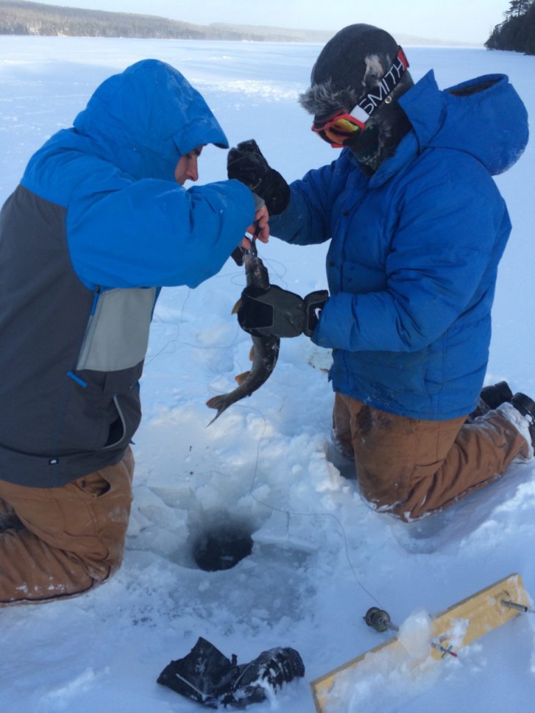
Boundary Waters Ice Fishing Lake Trout Tip up rod catch

Ice fishing can seem a little daunting. For one thing, it can be downright chilly and people are sometimes apprehensive to invest in the specific gear needed for ice fishing. But while you might have to work a little harder to succeed at ice fishing, that just makes the experience all the more rewarding. The specialized gear needed is limited to a few rods, ice scoops, and augers. Best of all, ice fishing is a great excuse to spend sometime outdoors in the winter months, even if you come home empty handed.

Throughout the year, we hear a lot of questions from those curious about trying their hand at ice fishing. What’s your favorite lure? What’s the best hand auger? Why don’t you use a sled to haul your gear? To answer all those questions and more, Andy put together this ice fishing gear video tutorial.

Don’t worry, you don’t need to make a list of all the gear Andy mentions in the video.  Just use our printable ice fishing packing list as an easy reference point when you pack for your next ice fishing adventure in the Boundary Waters Canoe Area Wilderness.

Ice Fishing PACKING LIST

Here’s one of the lures highlighted in the video:
Best Lake Trout Ice Fishing Lure

The DNR’s Lake Finder website is a great resource to guide you in choosing a Gunflint Trail lake to ice fish on. You can always give us a shout at 218-388-2221 for lake recommendations too.

Good luck anglers!


BWCA Trip Report: Granite River in High Water

Tuscarora Granite River Canoe Route

Since late winter, my friend Kati and I have been trying to plan a quick canoe trip. Like most canoe trips, even though it was just the two of us, it took a little finagling to sync up our schedules. Last week, we managed to carve out a sliver of time for a two day canoe trip and decided to tackle the Granite River Route. Kati’d paddled the route once during her three seasons as a canoe guide at Wilderness Canoe Base and I’d flirted with the route (aka a day trip to Sag Falls and another day trip to Clove Lake via Larch Creek) but had never paddled it in full.

DAY 1

14:25 – Kati rolls into Tuscarora. We quickly transfer all of her personal items into the gear pack that Andy and I threw together the night before.

14:50 – Depart Tuscarora for the Cross River Bridge on the North Gunflint Lake Road.

15:05 – Load the canoe and paddle off.

Kati near the Cross River Bridge on Gunflint Lake

We pass through the Gunflint Narrows into Magnetic Lake, but go through too quickly to really get a look at the trestle remnants hiding under the water from the old railroad bridge that spanned Gunflint Lake in the late 1800s. In Magnetic Lake, we pass our second historical highlight  – the Swiss Chalet style cabin on Gallagher’s Island. This unique cabin was built in the 1920s by the Gallagher family and it’s been carefully maintained ever since. Because it’s a private residence, we didn’t want to paddle right next to it, so our pictures don’t show how very cute it is, even from a distance.

Chalet Cabin on Magnetic Lake's Gallagher's Island

16:00 – Turn the corner and officially enter the Boundary Waters (although we missed the sign) and the Granite River. Reach our first portage of the day and spot the first of countless international border markers dotting the route. About 9 inches of rain had fallen on the Gunflint Trail in the last few weeks, so the portages are a little sloppy and/or flooded.

Canada/U.S. International Boundary Marker on the Granite River

16:40 – After another short portage, (and a slight bushwhacking stint) we arrive at the base of Little Rock Falls and snap some photos. Nourished from a quick handful of GORP, we soldier on. Thankfully, in June you have about 18 hours of daylight to paddle in each day, so we have plenty of time to set up camp yet.

Little Rock Falls between Magnetic Lake and the Granite River along the Gunflint Trail

17:15 – Arrive Wood Horse portage. There are moccasin flowers, false lily of the valley, and other spring wildflowers everywhere!

Paddling the Granite River between Little Rock Falls and Clove Lake

18:15 – We paddle by the Granite River’s first campsite, near where the Pine River flows in. The site is up on a high rock face and is uninhabited. We decide to press on and see if there are any open sites on Clove Lake. Halfway down the portage, we see that the campsite across the lake is occupied and hear voices coming from the other campsite near the portage. Neither of us had any desire to camp in the campsite on the far side of the lake (it has a great beach, but is a buggy site this time of year), so we turn around.

19:00 – Return to Pine River campsite. Unload gear. Grab pots and pans and paddle to the widest part of the river to fill up on water.

19:10 – I set up stove in the Pine River campsite, put water on to boil for supper. Kati scopes out tent pads.

19:20 – Water boils. Stir in red beans and rice mix with slices of bratwurst. Turn pot down to a simmer. Attempt to figure out how to set up Andy’s “Big Agnes” 2-person tent.

IMG_8874

19:40 – Test supper. Done! Take off heat, put water on to boil for dishes and to put in Nalgene bottles to cool over night for drinking the next morning. Return to tent pad to stake out tent.

19:45 – Dinner is served.

20:00 – Clean up campsite, tuck canoe behind trees for the night. Enjoy a spectacular sunset.

Granite River Boundary Waters sunset

21:10 – Turn in for the night

DAY 2

Corydalis on Granite River BWCAW campsite

Wake up to very noisy chickadees singing in the trees above our tent. Based on the light coming into the tent, figure it must be around 7 a.m. Go back to sleep.

07:10 – Decide to get going. Both shocked to discover that it’s only 7. Head out to the fire grate to put on water for oatmeal and tea.

08:00 – Enjoy a leisurely breakfast in the sunshine on the rock face overlooking the glass-calm Granite River. Realize that in a string of rainy, cold days we’ve somehow won the weather lottery for our short trip.

08:30 – Start packing up the campsite. We pause to take a lot of photos around the site, especially of the trio of moccasin flowers blooming towards the back of the site.

Pink Moccasin flowers blooming in the BWCA Gunflint Trail

09:20 – Slather on sunscreen and don ridiculous sun hats. Paddle to Clove Lake portage.

09:30 – Start the Clove Lake portage for the second time in as many days. Over breakfast, we decided against single portaging and I have a much happier portage than the night before. While I run back for the food pack, Kati stays at the Clove Lake side of the portage and repacks the gear pack so it rests better on her back so she can have happier portages for the rest of the day too.

10:20 – Paddle across Clove Lake. Both the southern campsites are full. This proves to be the most people we see all day.

11ish – Arrive at portage. Quickly discover that the first half of the 40 rod portage is ankle deep in squelching, boot swallowing muck, aka loon sh!t. We persevere and treat ourselves with several handfuls of GORP and big drinks of water at the portage’s end.

IMG_8913

11:40 – Push off again and enjoy a quiet paddle through an especially scenic portion of the river. After the mucky state of the last portage, neither of us is any big rush to make it to “Swamp Portage.”

12:00 – Arrive Swamp Portage. Not as bad as we had feared. A little buggy, sure, and the end of the portage is basically a river, but we spy tadpoles and frogs swimming in the portage pools and beautiful marsh marigold foliage frames the portage boardwalk.

Granite River portage, high water in June

12:25 – Feeling, to quote Winnie-the-Pooh, a little “11 o’clockish,” we decide to press on to Gneiss Lake before breaking for lunch. This means two more portages and a tricky bit of current stand between us a summer sausage and cheese sandwich lunch.

12:40 – Reach Granite River portage. Warmed by the first sunlight we’ve had in week, dragonfly nymphs are hatching near the portage landings. Bad news for mosquitoes – good news for campers!

Dragonfly nymph hatch in the Boundary Waters

13:00 – Around the corner from the portage, we navigate through the one bit of real current on the Granite River that you don’t portage around. We head for the deep center of the river and are merrily whisked down the river. Wheee!! Like going down a waterside! In the widening in the river after the current, we spy a pair of loons – the one creature Kati was hoping to see on the trip.

13:40 – We finish the Gneiss Lake portage and start looking for a campsite to eat lunch at on Gneiss Lake. The primo campsite on the island is taken and its residents are fishing nearby, so we settle on lunch on the rock face of the most northern campsite on the lake.

IMG_8952

14:20 – We pack up lunch and start making our way towards Devil’s Elbow and Marabouef Lake. We still haven’t decided if we’re going to camp on the Granite River or on one of the island sites on Saganaga near Sag Falls. We have to meet a towboat at Sag Falls at noon the next day, so making it to Sag means a quiet, slow morning tomorrow, but two more portages today. On the other hand, it feels pretty good to think that all the day’s portaging is already behind us.

We make our way slowly through the Devil’s Elbow and Marabouef Lake, swinging by each campsite to check it out.

15:50 – Find ourselves at the northern most peninsula with campsites on Marabouef Lake. Figure we can be on Sag by 6, but opt instead to camp on the last campsite on Marabouef, a north facing site tucked into a quiet bay.

16:40 – Do a water run, start boiling water and setting up camp.

18:20 – Enjoy a fine camp dinner of Pesto Pasta Primavera with Salmon. We don’t feel like bothering with a fire, so we just break s’more ingredients into our chocolate pudding and call that good enough.

Marabouef Lake campsite

19:00 – Clean up campsite. We cool off our Nalgenes filled with boiled water by putting them on a stringer and floating them in the lake. We take a gander at the map and try to determine when we need to depart the campsite the next morning to make it to Sag Falls by noon.

DSC00476

21:00 – Bedtime.

DAY 3

07:00 – Wake up. Slower start than the day before. No need to boil water, since we just need cold water to mix into our granola and neither of us are coffee drinkers.

08:00 – Start taking down the campsite.

09:15 – Depart campsite. The wind’s picked up and we have to paddle hard to turn the corner into the southerly wind. Once we’re headed the right direction though, the wind pushes us up the river towards our final destination. We stop paddling for a minute and realize that with the wind, we could reach Sag Falls in time for our pick up, even without paddling another stroke. Dark storm clouds start to gather and thunder rumbles in the background. We notice taller trees where the Sag Corridor Fire of 1995 burned the river.

10:10 – Reach Horsetail Rapids portage. Pull on rain pants and jacket. Start portage.

10:15 – Downpour starts.

10:20 – Downpour ends. I’m now hanging out on the base of lone cedar tree in the middle of calf deep water with the canoe on my shoulders. There’s a 30 ft. section of calf deep water covering the portage trail to the canoe landing on the other side of the portage. I can’t see how deep the water is and I really don’t want to slip in the water or onto the steep rock face next to the water with a Kevlar canoe on my shoulders. We opt to take the canoe off and two man it through the deep water.

Kati tackles the Horsetail Rapids portage in high water on the Granite River

10:50 – Depart Horsetail Rapids portage. Count our blessings that we decided to camp on Marabouef the night before instead of attempting to make it all the way out to Sag. Better to deal with flooded portages first thing in the day.

11:10 – Arrive Sag Falls portage.

Sag Falls at the end of the Granite River by Saganaga Lake

11:30 – Canoe and all gear at the tow boat pick up point on the Sag Lake side the Falls. Have snack. Wait for towboat.

Tuscarora Outfitters towboat driver Jack

12:00 – Jack arrives in the towboat.

DSC00579

12:40 – Reach public landing on Sag Lake Trail. It’s Friday and the landing is full of people loading up their boats to get to their cabins on the Canadian side of Sag.

13:10 – Arrive Tuscarora. Unpack Kati’s items. Rouge thunderstorm rolls in. Mark up Granite River map with all the insight we’ve gained from the trip. Start planning next year’s trip.


Going, going . . . .

Ironically, it took the sky raining ice for the lake ice to finally dissolve on the Gunflint Trail. We’re still not ice free yet, but it’s going fast.

Here are the latest ice out photos from this morning, April 25, 2016.

Round Lake, April 2016

Round Lake

Gunflint Lake April 2016

Gunflint Lake near the Cross River

Seagull Lake April 2016 Gunflint Lake Minnesota

Seagull Lake Blankenburg Landing

Gunflint Trail Saganaga Lake April 2016

Saganaga Lake Corridor, Tow Boat Dock