We’re hopping on the “photo or it didn’t happen” bandwagon today and rounding up our top 10 absolute favorite places to take winter photos on the Gunflint Trail. While you could absolutely take stunning photos at any of these locations year-round, we think these public spots in the Superior National Forest and Boundary Waters Canoe Area Wilderness really are at their photogenic finest under a beautiful blanket of snow.
These aren’t only the Gunflint Trail’s most scenic spots, they can also all be accessed via existing roads or hiking trails, so you can visit and photograph without worrying about creating a loved to death Instagram hotspot. Together, we can keep your followers happy by taking them along on your Gunflint Trail winter vacation while preserving the wilderness experience for future visitors. Your Instagram account will never have looked so good!
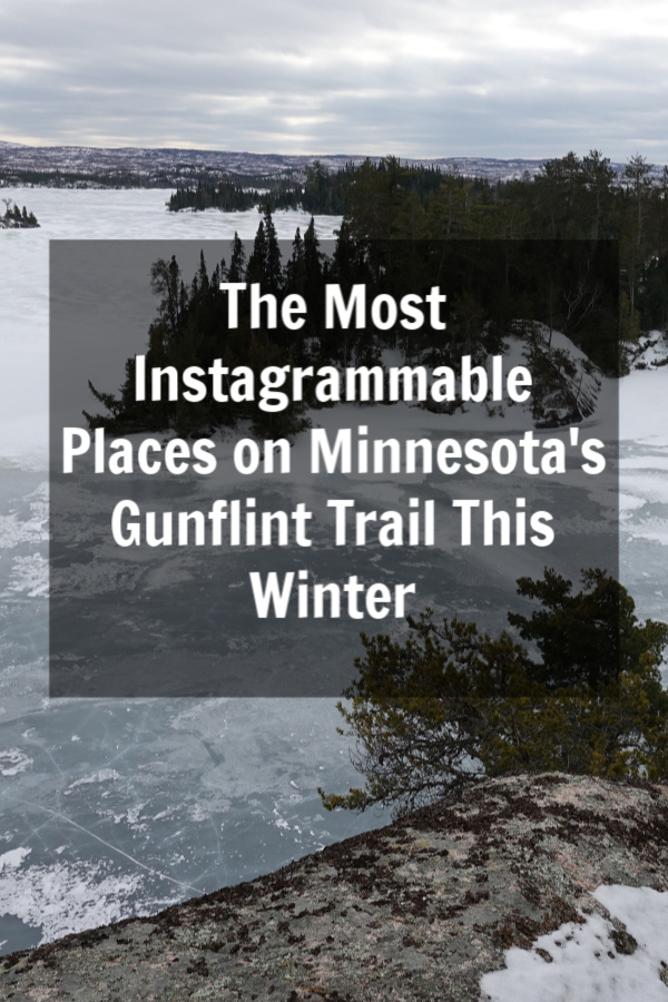
Top 10 Gunflint Trail for Instagram Photos
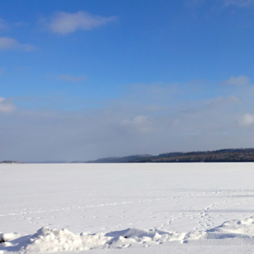
1) Snowy Gunflint Trail
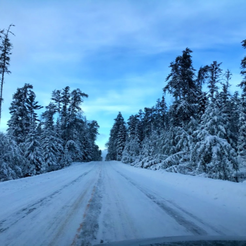
Let’s start with some low hanging fruit here. If you’re going to be on the Gunflint Trail in the winter, you’re going to have to drive on the Gunflint Trail in all its scenic snowy glory. If you’re looking for a spot to pull off to get a pretty shot of snow-flocked pines during your drive, consider the parking lot on the left-hand side just north of the South Brule River Bridge (approximately 19 miles up the Gunflint Trail) or the Swamper Lake pull-off (approximately 24 miles up the Trail) on the right. Remember, the Gunflint Trail Scenic Byway is a remote wilderness road, so drive carefully and watch for moose!
2) Caribou Rock Hiking Trail West Bearskin Lake Overlook
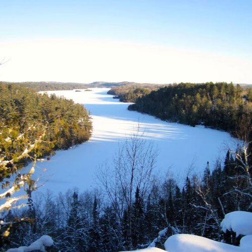
The Caribou Rock Hiking Trail is a seven-mile roundtrip hike in the Mid-Trail region of the Gunflint Trail, but you only need to hike the trail about a quarter mile to reach the Caribou Rock Overlook where you’ll find a spectacular eastern view of the entire length of West Bearskin Lake. Can you imagine how stunning your photos would be if you came here for sunrise? If you continue hiking, you’ll reach great vistas of Moss and Rose Lakes, eventually cross into the Boundary Waters Canoe Area Wilderness, and reach the waterfall along the Stairway Portage between Duncan and Rose Lakes. To access the trail, drive two miles down the Hungry Jack Road (Cook County Rd 65) to the public parking area.
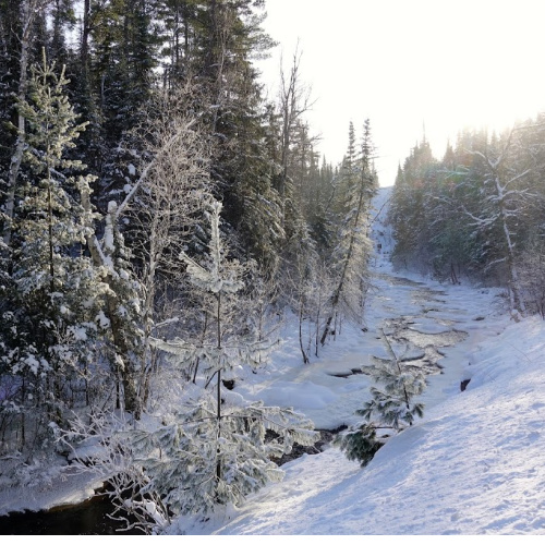
3) Bridal Falls on Gunflint Lake
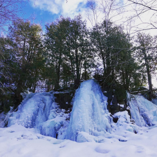
Located seven miles down Gunflint Lake, it’s definitely an adventure to reach Bridal Falls. Although you can access Bridal Falls from a spur trail off the Border Route Hiking Trail, the easiest way to reach this photogenic waterfall in the winter is heading down Gunflint Lake on either snowmobile or skis to the most eastern bay on the lake’s southern shore. From there, follow the (signed) path along the western side of the flowage about a 1/3 mile to the waterfall. This is a great subzero destination since the extra cold temps cause the waterfall to freeze in beautiful icy formations and the cold also knocks down any slush that could slow down your travels on Gunflint Lake.
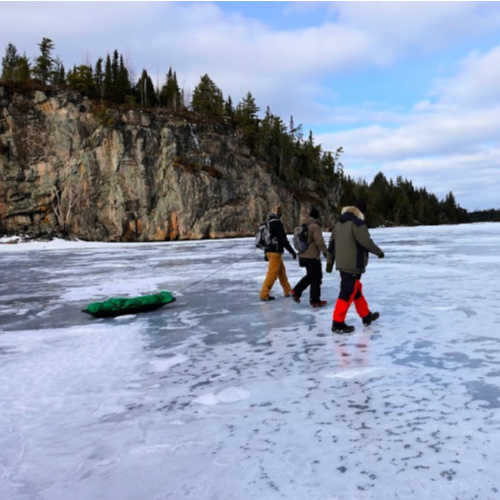
4) Any Boundary Waters Sign
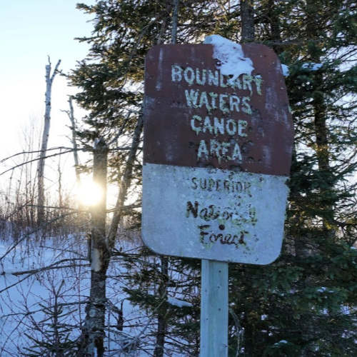
Anyone can say they went to the Boundary Waters this winter, but how are we suppose to believe you if you don’t pose in front of a Boundary Waters Canoe Area Wilderness sign to mark your official entrance in the federally designated wilderness area? You’ll bump into one of these signs whenever you enter the Boundary Waters from a public access point. From Tuscarora’s location on Round Lake, the fastest sign to reach is the one along the portage from Round Lake to Missing Link Lake. You’ll run into the sign about 1/3 of the way up the 142-rod portage.
Bonus points if you can find a sign that doesn’t have the word “wilderness,” which likely means the sign was placed before the 1978 BWCAW Act. We know where two pre-1978 signs are on the Gunflint Trail. Do you?
5) Cross River along the Round Lake Road
Sure, we’re biased, but we think the most beautiful spot on the Gunflint Trail that you can reach by car is the Round Lake Road (Cook County Rd 47) when you drive along the Cross River rapids about half a mile up the road from the Gunflint Trail. We love watching how the river changes with the seasons: from rushing rapids in the spring to being almost completely ice-covered during especially chilly winters. In the early winter, moisture from the river often settles on neighboring tree branches to create exquisite hoar frost or rime. If you’re especially lucky, you might spot an otter eating its catch near the top of the rapids and even if you don’t spot the otter himself, be sure to look for otter slide tracks that almost always line the river banks in winter. After you take your photos, turn around safely by continuing up the road to the turn-off to the Round Lake Public Access or turn around at Tuscarora Lodge and Canoe Outfitters.
6) Centennial Hiking Trail Overlook
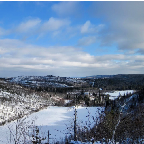
Besides the Magnetic Rock Trail, the Centennial Hiking Trail is a great Gunflint Trail snowshoe trail option. If you don’t want to hike the entire 3.3 mile loop, we think you get your best photo-op just a little ways up the trail from the Round Lake Rd when you come to a sweeping vista of the beaver ponds below and a glimpse of both the Gunflint Trail and Gunflint Lake in the distance. To reach the overlook, park at the Centennial Trail pull-off about 3/10ths of a mile up the road after you turn off the Gunflint Trail. To hike the entire trail, park at the trailhead’s parking lot located approximately 48 miles up the Gunflint Trail on the left-hand side.
7) George Washington Pines
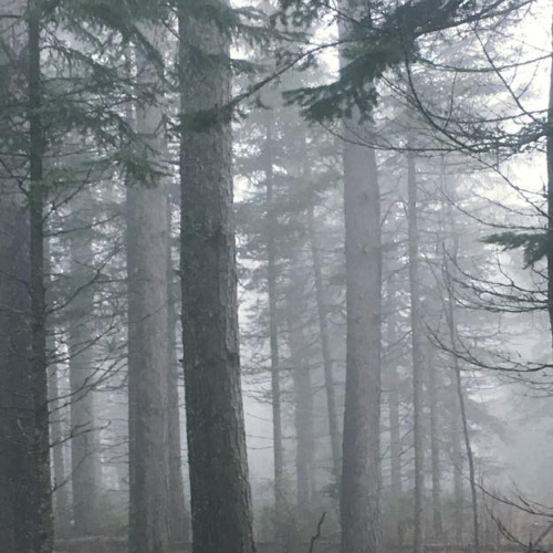
Just ten minutes outside of Grand Marais, the George Washington Pines is a favorite local destination in winter for its easy 3.3 km loop groomed cross-country ski trail through a 1932 Boy Scouts red pine plantation. There’s something magical about standing in an old growth forest where every tree you see is older than you and you might just think you’re catching glances of Narnia’s Mr. Tumnus in your peripheral vision as you ski through the Pines. This is also a great place to stop if you want a photo of one those quintessential “Superior National Forest” Forest Service signs.
8) Gunflint Lake from North Gunflint Lake Rd
One of the easiest spots to getting a sweeping panoramic shot of a Gunflint Trail border lake is from the snow plow turnaround spot just before the Cross River Bridge on the North Gunflint Lake Road (Cook County Rd 46). From this spot, you’ll capture Canada on the left hand side and the U.S. on the right side of your photo and you’ll spy cliffs on North Lake a good ten miles off in the distance. In you swing by this spot for a photo-op, don’t forget to look behind you. The cattail marsh next to the Cross River as well as views from the bridge are absolutely beautiful in the winter!
9) Seagull Palisades
Perhaps the most photographed spot on Seagull Lake, the Seagull Palisades located about halfway down the lake’s north shore are on of the Gunflint Trail’s most rewarding photography destinations. They look beautiful photographed from the ice below, photographed up close, or from following a trail on the west side of the cliffs to reach the top for a birds-eye view of the BWCA. You’ll have to venture into the Boundary Waters to get these photo, so don’t forget to grab a day-use permit at the Seagull Lake Public Access before you and your iPhone head out.
If you head out to the Palisades this winter, we definitely recommend approaching them from the south, since the ice is notoriously sketchy in the narrow channel directly east of the Palisades between the lake’s north shore and an island. For this same reason, in winter, we favor using the main Seagull Lake Public Access on the southeast shore of the lake (also referred to as Blankenburg Public Landing) rather than tangling with the thin ice you can run into from the public access at Trail’s End Campground.
10) You With A Fish
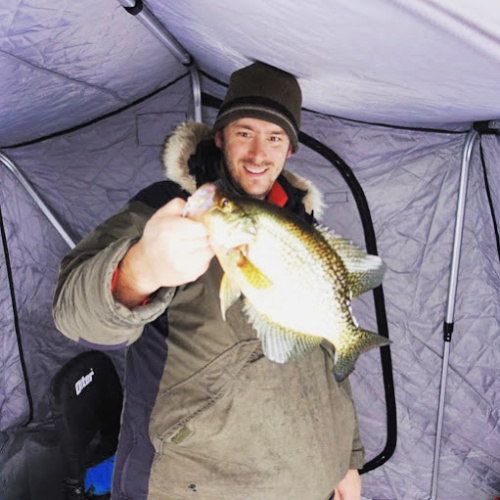
We’re guilty as charged: our Instagram account is mostly fish pics from about mid-December until the end of March. (Sorry, not sorry. We know what we like . . . .) One of the Gunflint Trail’s biggest winter draws is its access to world-class ice fishing and whether you’re going for lake trout, walleye, crappies, or smallmouth (hey, it’s happened!) through the ice, be sure to snap a photo of you and your fish on ice before you pop it back in the drink. #catchandrelease!
What are your favorite places to take photos on the Gunflint Trail in the winter?
We know we skipped a few crowd favorites: Honeymoon Bluff, Magnetic Rock, and the Clearwater Palisades to name a few. Let us know in the comments below!