Category: Boundary Waters Day Trips

A round up of our favorite BWCA day trips from our Gunflint Trail base outside Grand Marais, MN

Snipe Lake Loop Day Trip

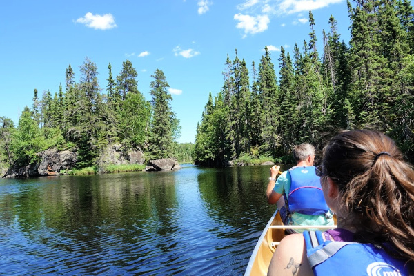
Last June, I was able to sneak out for an afternoon day trip on the Snipe Lake Loop with my brother and sister-in-law when they were up. This short Boundary Waters Canoe Area Wilderness canoe route basically loops through Tuscarora’s backyard. We frequently send cabin guests and a handful of overnight campers on this route because it’s convenient, scenic, and provides an excellent introduction to the BWCA.  

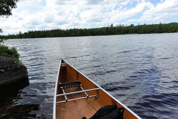
It was a glorious sunny day, so we grabbed a three-person Kevlar canoe and off we went . . . . 
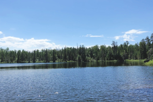
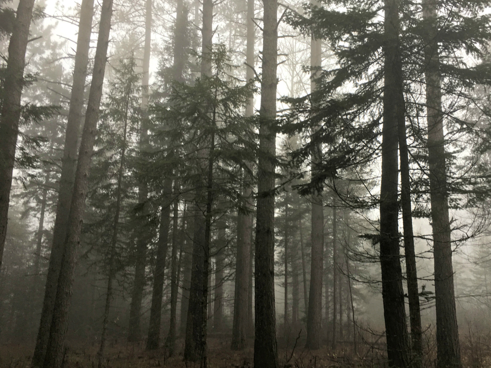
Missing Link Lake

As the name “loop” implies, this route can be done in two directions, either starting on our beach on Round Lake, or just down the Round Lake Road (County Road 47) at the public put-in for Cross Bay Lake. The three of us opted to start at Tuscarora for a couple reasons. Logistically, it was just easier to start at the beach since our canoes are right there and we didn’t have to monkey around with shuttling ourselves and canoe down the road . . . even if it is only 300 yards away from the outfitting building. I also liked the idea of getting the two longer portages done first thing (the portage from Round to Missing Link is 142 rods and the portage from Missing Link to Snipe is 180 rods), although by doing the route in the counterclockwise direction, we of course had more uphill portaging . . . . Clearly, a compelling argument can be made for doing the loop in either direction. 

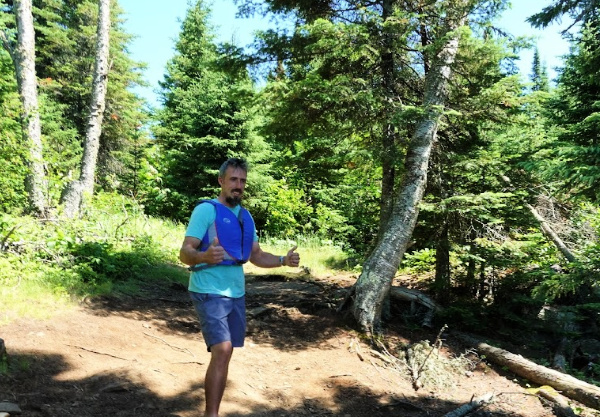
Brother at the Snipe Portage landing on Missing Link

It was a mid-week afternoon in late June and the woods were still pretty quiet. We ran into a group coming across the Missing Link portage, then passed a large group on the first campsite on Missing Link. From then on, we had the woods to ourselves. 

One of the nice things about doing the Snipe Lake Loop with three people in a three-person canoe is that it’s easy to navigate the single biggest challenge on the entire six-mile route. About a quarter of a mile down the portage between Missing Link and Snipe Lake, you come to a large boulder that slopes down into a ravine. It’s only about a seven foot dip, but it can be a bit of a poser on how to tackle it when you come to this “valley” with a canoe on your shoulders. If you’re traveling by yourself or just one other person, the only real option is to set the canoe down, get yourself down the rock face, then collect the canoe and carry on. 

My brother Peter was portaging the canoe when we reached this point, so his wife Ashley and I just grabbed the two ends of the canoe and held it up while Peter walk out from under the canoe and down the rock face. Once he was on level footing again, we just set it back down on his shoulders and continued on to beautiful Snipe Lake.
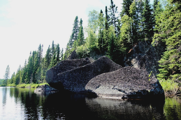
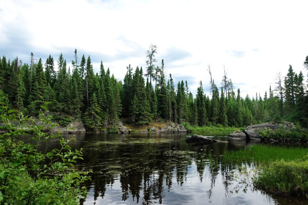
Snipe Lake

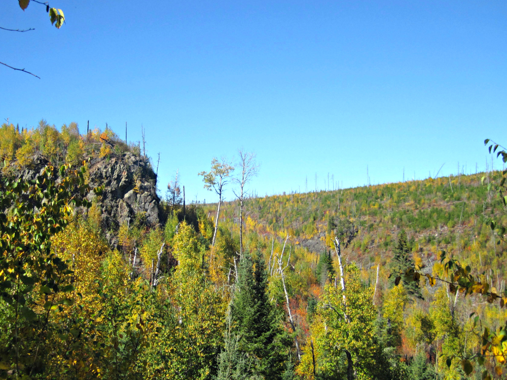
Snipe Lake really is a gem. Even though you’re only a couple miles into the BWCA, it feels like you’re deep in the wilderness. It has dramatic rock features, twisty canyons, and lush forest. It’s not a great lake for fishing (it just has small northerns) but with four campsites and not a lot of traffic, it’s a good option for people who want to feel like they’re in the remote wilderness without actually traveling very far. 

That said, there’s some debate about whether the Snipe Lake Loop is “easy.” Because of its convenient location, many Tuscarora guests get their first taste of the Boundary Waters on the Snipe Loop. It’s not the easiest Boundary Waters canoe route in the world, but it has several factors that push it into the “easier” category, namely that you only travel six miles to complete the whole loop meaning it can be done in about three and a half hours of continuous paddling and portaging. It’s also only on small bodies of water so you don’t have to worry too much about wind conditions. While two of the portages are longer, all of the portages are well traveled and well maintained.

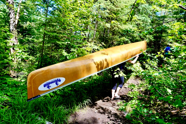
But every Boundary Waters trip inherently challenging on some level and even the easiest BWCA trip isn’t a walk in the park. (I actually wrote a whole blog post about the Boundary Waters not being a park a couple years ago.) As you can see in the photo above, the portages can be mucky. On Cross Bay Lake, the person in the bow needs to watch in front of them so the canoe doesn’t get hung up on the bottom or rocks as you paddle the shallow areas near the portages. 

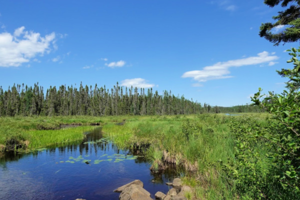
When you take off on Cross Bay Lake from the Snipe portage, you meander down a shallow, twisty waterway about creek-width. Be sure to watch for blooming pitcher plants if you’re paddling through in early summer. We literally saw hundreds of these carnivorous flowers in bloom as we paddled by – the most I’ve ever seen in one location.  Although we didn’t see one on this trip, Cross Bay Lake is also know to be a bit of a moose viewing hot spot. 

Cross Bay Lake

As you portage from Cross Bay Lake into Ham Lake, you’ll exit the Boundary Waters. You still have two portages to go to reach the public landing though. Ham Lake is completely outside of the Boundary Waters Canoe Area Wilderness, but still in the Superior National Forest. That means the four campsites on this lake are “dispersed sites” aka first come, first serve campsites that don’t require an overnight permit (or camping fee) to camp here. As a result, this lake can be pretty busy in the Boundary Waters high season (late July – mid August) when Boundary Waters permit quotas are filled, but people are still looking to get a BWCA camping experience. It’s also a lake that people frequently camp on for the last night of their overnight trip down to Long Island Lake or beyond, because Ham Lake has a good population of walleye and bass. Despite these facts, all four campsites were empty when we paddled past. 

From Ham Lake, we continued on for the “portage/paddle/portage/paddle” around a couple sets of rapids on the Cross River back to the public landing. From there, we did a quick 1/3 mile walk up the road back to Tuscarora. Although we did the trip as a day trip, I could see why you’d choose this route for an overnight trip. For such a short BWCA route, it really has some great campsite options, especially if the purpose of your trip is to relax and recharge and fishing isn’t much of a priority.

Have you done the Snipe Lake Loop before? 

The Best Fall Color Hikes on the Gunflint Trail

RoundLakeFallColors

We think every season is hiking season on the Gunflint Trail. However, it’s seems like for many people, autumn holds the title of “favorite hiking season.”  Although the Gunflint Trail doesn’t boost a large population of maple trees like the Lutsen/Tofte area of Cook County closer to the shore, the fall color season is still pretty stunning, with crimson moose maples, golden aspens and birch, and blazing tamaracks.  

As we approach peak fall colors on the Gunflint Trail, here are some of our favorite “leaf peeping” hikes. 

FallColorsCentennial

Since it’s basically our backyard, we recommend the Centennial Hiking Trail year-round, but the trail really is in its elements in the autumn. A 3.3 mile loop, you’ll want to budget about 2 hours of hiking time for this moderately difficult hike. Not only will you view abandoned mining test pits and walk on a 19th century railroad grade, the second half of the hike offers great vistas, especially looking across the Round Lake Rd beaver ponds towards Gunflint Lake. 

CentennialVista

Access the trail from either a small pull-off  on the Round Lake Rd (located just past the beaver pond – do not park by the snowmobile trail crossing) or the Kekekabic Hiking Trail parking lot about .5 miles up the Gunflint Trail from the Round Lake Rd.  

IMG_6816

You can certainly get some nice fall color views from the Magnetic Rock trail, especially from the open rock faces overlooking spruce and tamarack bogs, but for the best fall color vistas around Magnetic Rock, we recommend Magnetic Rock as approached from Warren’s Road. We did this 3.3 mile hike (one way – assuming you park a car at each end of the trail, or 5 miles if you want to hike back to Tuscarora) back in late fall 2015 and loved the panoramic view offered of Gunflint Lake and beyond. As you hike northwest towards Magnetic Rock, you’ll both view and hiking through a valley. You can read our full write-up here

If you don’t want to go all the way to the end of the Gunflint Trail, consider swinging into the Northern Light Overlook parking lot about 13 miles up the Trail from Grand Marais. From there, you’ll access a short, but very steep hiking trail and within 20 minutes time, you’ll be drinking in view of Northern Light Lake, the Brule River, and the Gunflint Trail. This trail is sometimes referred to as “Blueberry Hill” (not to be confused by a hike of the same name on the grounds of Chik-Wauk Museum and Nature Center), but all the signage refers to Northern Light.    

Fall Washington Pines

What You Need to Know About Blueberry Season on the Gunflint Trail

The Second Annual Biggest Blueberry Contest on the Gunflint Trail is just around the corner. Blueberry season, aka “the most wonderful time of the year,” is celebrated by Gunflint Trail residents and visitors alike. This plentiful wild edible is a staple of a Northwoods diet and picking berries is a favorite Gunflint Trail pastime.  

Around here, our measurement unit of choice for blueberries is gallons. You can have your cups, your pints, your handfuls of blueberries to toss on oatmeal. We’re in it to win it. And by win it, we mean, enough blueberries in the freezer to have a pie every month of the year. 

While we’re not about to tell you where our favorite berry patches are, here’s some berry season insight to help you play with the blueberry picking big dogs. 
Blueberry1

I personally use July 20th as the Gunflint Trail blueberry season’s official start date because more often than not, there’s a pick-able amount of ripe blueberries then. However, I usually wait until the first week of August before heading out picking myself because I prefer not to have to pick around unripe berries. Most years, ripe berries remain on the plants through the end of August, although they will start to shrivel and become overripe, making picking a little trickier if you wait until the late season. 

Of course, in years with very early springs (i.e. 2010 and 2012) the berry season can be bumped up by as much as a full month. Although that’s certainly not a risk this year, keep in mind that if area lakes were mostly ice-free by mid-April,  you could very well be picking blueberries over Fourth of July weekend. 
BlueberryBlossoms5212012

Blueberries aren’t a particularly finicky plant (after all, they’re Northwoods natives:  they’re tough by nature) but a bumper crop is dependent on the plants get just the right amounts of sunshine, heat, and rain. The worst weather event that can befall blueberry plants is a late frost that kills the berry blossoms. A low rain summer yields small berries, but too much rain results in less flavorful berries.

You can find blueberry plants throughout Cook County and northern Minnesota, but the bushes are particularly plentiful along the upper Gunflint Trail where the bushes prefer the jack pine forest and sandy soil ecosystem on this part of the Trail. Basically, if you take a left off the Round Lake Road and head towards the end of the Trail, you’ll be in prime blueberry territory. 

When you’re scoping out a berry picking spot, watch for south facing slopes with a little shade so the berries can retain moisture and plump up. For the most plentiful berries, take a few steps off the hiking trail or preferably get in a canoe and paddle down a Boundary Waters lake. Favorite berry picking spots include the Magnetic Rock hiking trail, Seagull Lake, and the Granite River. 

IMG_2305

Gunflint Trail blueberry season first-timers might be a little confused about what blueberry season is all about. Blueberry season is an informal event around here. You don’t need any permits or to pay any picking fees. You’re also completely on your own for finding berry patches: this is no “u-pick berry farm” situation. Once you know that all the cars parked along the side of the Gunflint Trail belong to berry pickers who are deep in the forest, you’ll realize just how many places there are to pick blueberries. 

Really, the only rule for picking blueberries on the Gunflint Trail is to make sure you’re on public land. The Superior National Forest map that can be purchased for about $10 at the Gunflint Ranger District office is a great resource for helping you know when you’re on National Forest land.

IMG_2367
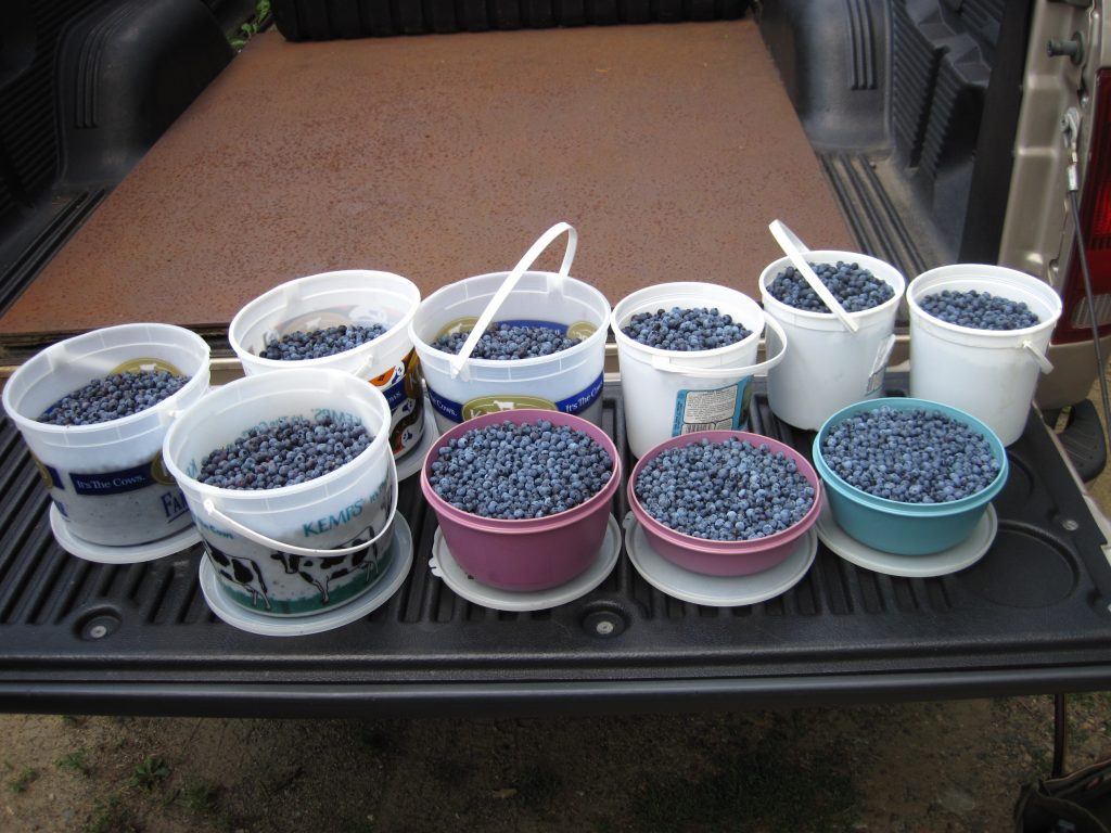
You’ll need to provide your own berry picking containers. Gallon sized ice cream buckets with lids (to prevent spillage when you walk over the rocky terrain back to your car) are the berry picking vessel of choice around here. 

One very legitimate worry among first-time berry pickers is whether or not they’ll be able to identify the berries. The question I tell people to ask before they eat a berry that is a blue color is: Is it wearing a crown? All edible blueberries have a puckered blossom mark on their bottoms (non-stem side). Whether you find actual blueberries or if you happen upon some huckleberries or juneberries, if the berry’s wearing a crown, it’s edible . . . and delicious. 

But if you find a large, completely smooth, navy blue berry on a long stalk, don’t pick it. That’s a blue bead lily (or clintonia) and while it won’t kill you, you might end the day with an upset tummy if you eat it. Luckily, clintonia are a completely different color and have completely different foliage from blueberry plants so once you know how to identify them, you will never confuse the two plants. 

BlueberryPie

Tuscarora Lodge is an “official weigh station” for the Biggest Blueberry Contest, so swing by after your day in the berry patch to enter the contest. We promise we won’t ask you where you picked the berry and we’ll even let you eat it after it’s weighed. Happy picking!

Watch the video below to come along on one of our berry picking adventures!